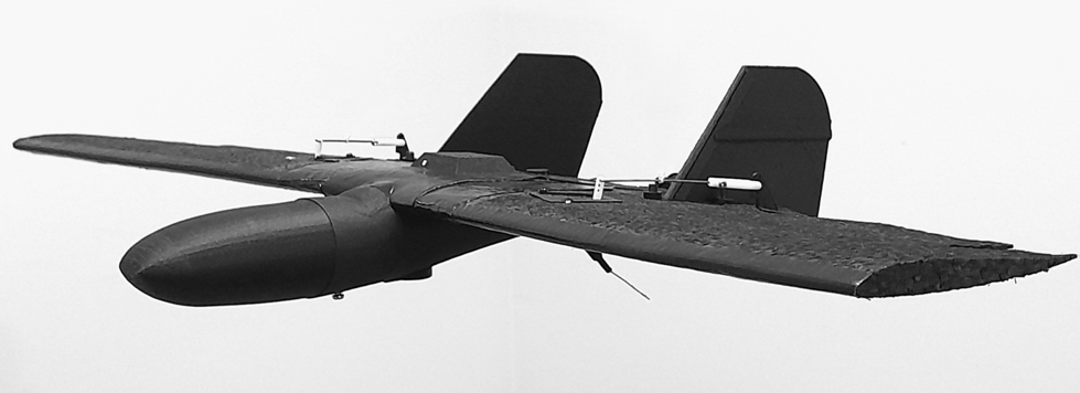
Aircraft Cartographer Mini PPK/RTK weighing less than 250 grams
RTKNAVI is a service used for precision agriculture, geodesy, construction, and drone management. It provides an easier automated setting to connect a fixed receiver (base station) and a mobile receiver, making it easier for users to connect their devices without having to delve into the complex technical details of the connection. Additionally, RTKNAVI automatically determines the exact position of base stations, automatic switching between verified base stations without losing accuracy, and monitoring the quality of moving devices in real time with the display on the map. The service can be used with any type of device, regardless of the production.
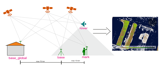
 let's try to tell a little about how satellite navigation works.
rtk laboratory: for precision farming.
rtk laboratory: for geodesy.
rtk laboratory:for experiments.
rtk laboratory:for drones and self-driving cars.
rtk laboratory: an invitation to collaborate.
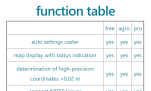 function table RTKNAVI Service.
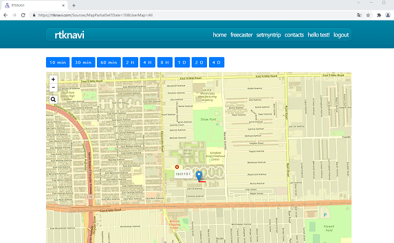
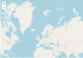 Online map of RTK Free NTRIP Caster bases
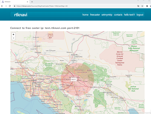 Example of RTK Free NTRIP Caster setting
 Example of setmyntrip autosetting
 express processing of aerial photography data